The Demarcación de Costas has reopened 549 metres of the Marbella coastal boundary at Río Real, and a second stretch of 361 metres in Estepona between the Villacana urbanisation and the Arroyo Taraje. Both are formal rectification files, both are in public information right now, and the Marbella window closes on 5 October with a site survey the following morning. Anyone who owns near either stretch has a month in which their position is decided.
These files move the line between state property and private property. That is a bigger thing than it sounds, and it is the reason we track every coastal procedure on this stretch of the Costa del Sol rather than waiting for a buyer’s lawyer to find one during a search. What follows is what the Marbella coastal boundary actually is, what a rectification can and cannot do to a title, and where the two open files sit.
What Costas has reopened at Río Real
The Marbella file is referenced DES01/05/29/0009-DES07/01. It moves part of the Marbella coastal boundary by rectifying the ribera del mar between vertices M-107 and M-113 and reviews the maritime terrestrial public domain between M-114 and M-118, across roughly 549 metres. It rectifies a boundary that was approved by ministerial order on 29 November 2007, so the line being changed is nearly twenty years old and predates most of what has been built and sold behind it.
The public information period runs from 4 September to 5 October 2026. The site survey, the apeo where the engineers walk the line and stake it on the ground, is set for 6 October at ten in the morning at the Trocadero Arena on the Río Real beach, at kilometre 186 of the N340. That survey is a formal act, and what is recorded there carries weight in everything that follows.
The three lines behind the Marbella coastal boundary
Owners tend to think of the coast as one boundary. Spanish coastal law works with three, and the difference between them decides what an owner may do. The first is the dominio público marítimo terrestre, the maritime terrestrial public domain, which belongs to the State. Nothing inside it is private property, whatever the deed and the Land Registry say, and this is the line a rectification moves.
Behind it sit two easements that stay in private ownership but carry restrictions. The servidumbre de tránsito is six metres deep and must be kept clear for passage and for coastal rescue and surveillance. The servidumbre de protección runs to 20 metres where the land was already urban when the 1988 coastal law came in, and 100 metres where it was not. New residential building inside it is barred, and works there need authorisation from the regional administration on top of the municipal licence.

Because the two easements are measured inland from the public domain line, moving that line moves both of them with it. A rectification of a few metres at the water can pull a protection band across a garden, a pool or a terrace that has sat outside it for two decades. That is the mechanism, and it is why a short technical notice about 549 metres deserves more attention than it usually gets.
Why a coastal boundary gets rectified at all
Boundaries move because the coast does. The public domain is defined by where the sea reaches in the biggest known storms, so a decade of erosion, a run of severe weather, a beach nourishment scheme or the construction of a breakwater all change the ground the line was drawn on. Add the surveying itself, which was done to a different standard in 2007 than it is now, and a twenty year old line is often simply out of date rather than wrong.
Court rulings push in the same direction. Owners along this coast have challenged boundaries for thirty years, and where a challenge succeeds the administration has to redraw. That is why the notices are worded as rectification and revision rather than as a new deslinde, and why a stretch of a few hundred metres gets its own file instead of the whole municipality being redone at once.
What a rectification can do to a property, and what it cannot
A rectification of the Marbella coastal boundary does not expropriate anyone and it does not cancel a purchase. What it does is restate where the public domain sits, and everything landward is then measured from the new position. Where the line moves inland, part of a plot can fall inside public domain, and the owner’s right converts into a concession, which is a right to occupy and use for a term rather than to own.
Where the line moves seaward, and it does move that way too, land that was public becomes private again and restrictions that applied for years fall away. Both outcomes happen in these files, which is why the phrase in the notice is rectification rather than extension. An owner reading the reference alone cannot tell which direction their own metres are going, and that is exactly the question worth answering early.
A concession is not a consolation prize, and it is worth understanding before the word frightens anyone off a purchase. It is registrable, it can be sold and inherited with the property, and it runs for a long term with the possibility of extension. What it is not is freehold, and a lender will treat it differently, which is the practical reason the Marbella coastal boundary shows up in a mortgage file rather than only in a lawyer’s report.

The practical consequences are all downstream of that one line. Whether a terrace can be enclosed, whether a pool can be rebuilt where it stands, whether a first line villa can be extended rather than only repaired, and what a bank’s valuer will accept when the mortgage is being written. We hold our own cadastral and planning records along this coast, built up over years of due diligence, and setting a plot against the proposed line is the exercise that answers all four at once.
The Estepona stretch, Villacana to Arroyo Taraje
The second file, DES01/99/29/0001-DES04/01, covers 361 metres running from the Villacana urbanisation to the Arroyo Taraje. Its initiation order is dated 21 August 2026 and its public information period runs from 8 September to 8 October. It sits in the western coastal strip of Estepona, in the stretch that has seen the most new building of anywhere on this coast in the last five years.
That timing matters more in Estepona than the length of the stretch suggests. A great deal of recent product there was designed, licensed and sold against the boundary as it stood, and a rectification restates the reference every one of those decisions was measured from. Buyers looking at Estepona should know that the coastal line in this particular strip is live rather than settled, and it is a straightforward thing to check before an offer rather than after.
The Estepona file also sets a useful marker for anyone reading the Marbella coastal boundary review in isolation. Two separate stretches on the same coast, opened three weeks apart by the same demarcation, tells you this is routine administrative work rather than a policy shift. It is the pace of it that has changed, and a buyer or an owner is better served by knowing which files are open than by any general reassurance about the coast.

The dates that close this Marbella coastal boundary review
Two windows are open on the Marbella coastal boundary and neither is long. Marbella closes on 5 October 2026 with the site survey the next morning, and Estepona closes on 8 October 2026. After that the demarcation writes up the file and it proceeds toward a ministerial order, at which point the new line is the line.

Submissions during the window are the cheap moment to correct an error. Afterwards the route is a formal appeal, which is slower, costlier and starts from a position that has already been approved. If a property of yours sits anywhere near either stretch, ask us and we will establish whether it is inside the affected metres and, where it is, work with your lawyer to get the submission in before the window shuts.
JUST Real Estate has tracked sold data over many years and has compiled the JUST Intelligence Database™, which holds data no other agency has. We can accurately compare your property to neighboring sales and stats, so our competitive market analysis gives you the advantage in a buyer’s market.
Where the new general plan meets the coastal line
These two files land in the same month as Marbella’s new general plan, and the two are connected. The plan brings in a rustic protection category covering the maritime public domain and the coastal corridor, and it draws that zoning from the boundary as recorded when the document was drafted. Our piece on what the new plan changes on day one sets out the rest of it.
So the municipal plan and the state boundary are two separate instruments describing the same strip of ground, on two different clocks, and neither waits for the other. That is not a flaw in either system, it is simply how competences are divided between the State and the region. For an owner it means one document is never enough to answer the question, and the PGOM guide is kept current for the municipal half of it.

What we check before a beachfront purchase
On any first line property we establish four things about the Marbella coastal boundary before a client commits, and none of them are visible from the terrace. Where the current public domain line actually runs against the plot, rather than where the fence is. Whether an open rectification or review touches the stretch. Which of the two protection depths applies, 20 metres or 100. And whether any part of the existing building already sits under a concession rather than freehold title.
None of that stops anyone buying on the front line, and it should not. The best addresses in Marbella and on the Golden Mile are where they are for a reason, and the coastal regime has applied to them since 1988 without denting demand. What it changes is what you pay, what you can build afterwards, and how quickly a lawyer can close. The buyers guide covers where in the process each of those questions belongs.
Owners are in the same position from the other side. A seller who can hand a buyer’s lawyer the coastal position on day one removes the single most common reason a beachfront sale slows down in the middle. Our sellers guide sets out what a prepared file looks like, and telling us what you are looking for is the fastest way to get a specific address checked.
Questions about the Marbella coastal boundary
What is a deslinde and how does it affect the Marbella coastal boundary?
A deslinde is the administrative act that fixes where the maritime terrestrial public domain ends and private property begins. Everything landward is measured from it, including the six metre transit easement and the 20 or 100 metre protection easement, so the Marbella coastal boundary decides what an owner can build, enclose or rebuild.
Which part of the Marbella coastal boundary is under review in 2026?
Approximately 549 metres at Río Real, between vertices M-107 and M-118, under reference DES01/05/29/0009-DES07/01. It rectifies the boundary approved by ministerial order of 29 November 2007. Public information runs to 5 October 2026, with the site survey on 6 October at 10am at the Río Real beach.
Can I lose my property if the coastal boundary moves inland?
You do not lose the property. Where the line moves inland over part of a plot, the right over that part converts from ownership into a concession, a right to occupy and use for a term. The rest of the plot is unaffected, and the line moves seaward in some stretches, which returns land to private title.
How far back does the Marbella coastal boundary protection easement go?
Twenty metres where the land was already classified as urban when the 1988 coastal law came into force, and 100 metres where it was not. Which one applies to a specific plot is a question of that plot’s classification in 1988, not of how it looks today.
Is Estepona affected as well as Marbella?
Yes. A separate file, DES01/99/29/0001-DES04/01, covers 361 metres from the Villacana urbanisation to the Arroyo Taraje, opened on 21 August 2026 with public information running to 8 October 2026. Ask us and we will tell you whether a specific address sits inside either stretch.
The Costa del Sol property market continues to evolve, but informed decisions begin with reliable data. Download the JUST Q1 2026 Marbella Property Market Report today and gain exclusive insight into one of Europe’s most resilient and internationally driven residential markets.

DOWNLOAD OUR Q1 2026 MARKET REPORT NOW
Research enquiries:
James Evans — Managing Partner
📞 +34 643 390 376 | ✉️ james@justrealestate.es
Sales enquiries:
Alina Nouaimeh — Partner
📞 +34 600 689 749 | ✉️ alina@justrealestate.es
FAQ
Is the JUST Market Report free to download?
Yes. The report is available as a complimentary download and provides professional analysis of the Marbella, Estepona and Benahávis property markets.
Who is the report designed for?
The report is written for buyers, sellers, investors, developers, relocation clients, family offices and anyone seeking accurate, data-led insight into the Costa del Sol property market.
Where does the data come from?
Our analysis uses official information from Registradores de España, INE, Notariado, Tinsa, Banco de España and other recognised industry sources, combined with our own market observations and research.
How often is the report updated?
JUST Real Estate publishes a comprehensive market report every quarter, ensuring readers have access to the latest available market intelligence.
Our latest listings
View our latest listings of luxury properties for sale, where sophistication and comfort come together for an exceptional living experience.

5 bedroom villa for sale in Mijas
- 5 beds
- 6 baths
- Plot: 1,805 m²
- Interior: 465 m²
4 bedroom villa for sale in Mijas Pueblo, Mijas
- 4 beds
- 4 baths
- Plot: 580 m²
- Interior: 150 m²

4 bedroom villa for sale in Mijas
- 4 beds
- 4 baths
- Plot: 580 m²
- Interior: 150 m²


6 bedroom villa for sale in Mijas
- 6 beds
- 4 baths
- Plot: 658 m²
- Interior: 360 m²

5 bedroom house for sale in Valtocado, Mijas
- 5 beds
- 4 baths
- Plot: 41,000 m²
- Interior: 378 m²


4 bedroom villa for sale in Mijas Pueblo, Mijas
- 4 beds
- 4 baths
- Plot: 1,974 m²
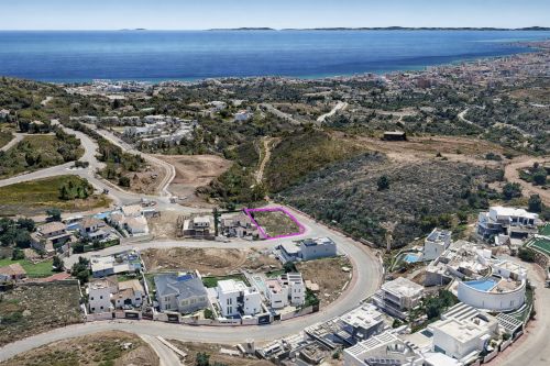
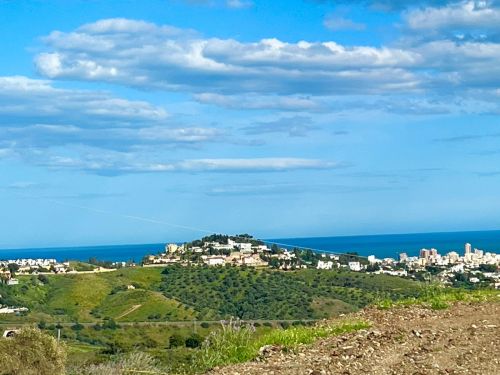
Plot for sale in Loma del Flamenco, Mijas
- Plot: 847 m²